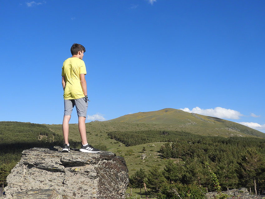
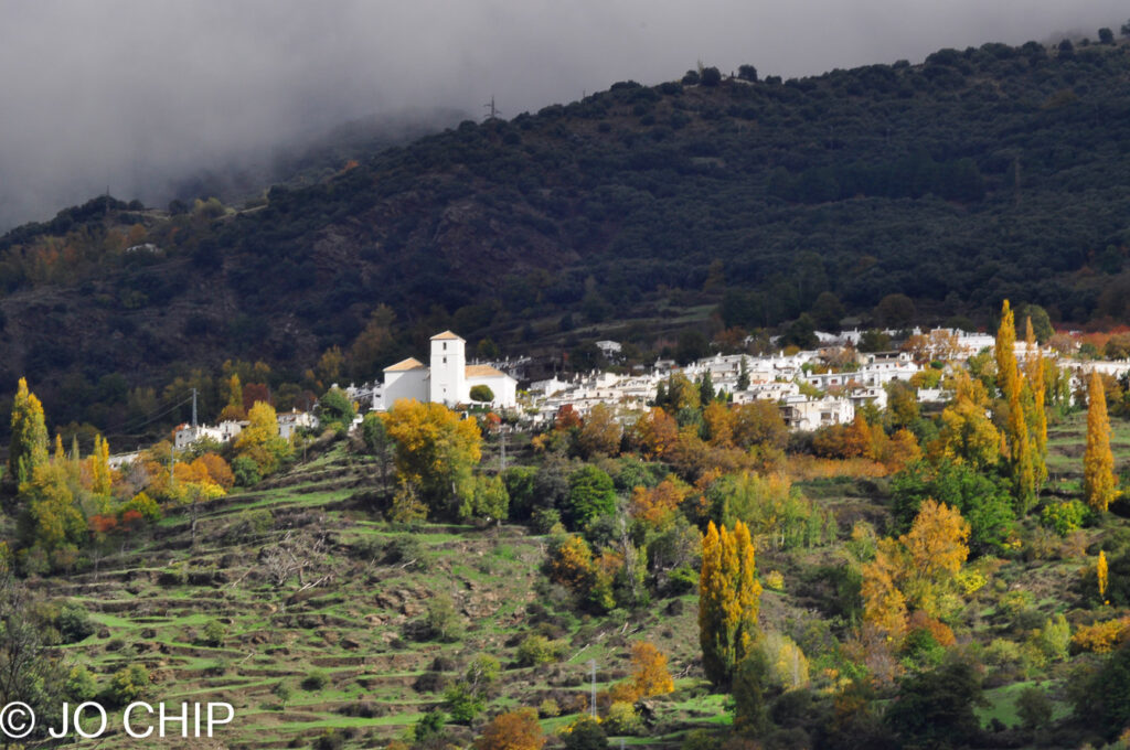
LYING on the south side of the Sierra Nevada mountain range, La Alpujarra is popuar with tourists. This is an area of natural beauty close to the mountain peaks and the sea. It spans the provinces of Granada and Almeria, with many white villages, valleys, and rivers.
Over the last few decades, the key industry of La Alpujarra has largely changed from agriculture to tourism. However, in rural areas – where time could practically have stood still – you will encounter mules, donkeys, goat herds, and traditional crops being farmed. The area is renowned for its almonds and olives and its vino del terreno’ (wine of the land), made from locally-grown grapes. It’s also famed for its spectactular landscapes, ancient waterways, and a wealth of fauna and flora.
Some fatures of La Alpujarra are outstanding and you should visit them! South of Granada has compiled a ‘bucket’ list of seven of the most impressive tourist attractions. Some of our Seven Wonders of La Alpujarra are seasonal, while others exist all year round.
Fuente Agria, Portugos
Lying just past Portugos in the Alpujarra Alta (high Alpujarra), Fuente Agria means “fountain of sourness”. The crystal clear mineral waters in this fountain flow down from the Sierra Nevada peaks and emerge from four pipes at the nearby ‘ermita’ (small chapel). Here, you can sample them all. These waters, recognised in Arab times, are rich in minerals and reputed to benefit your health.
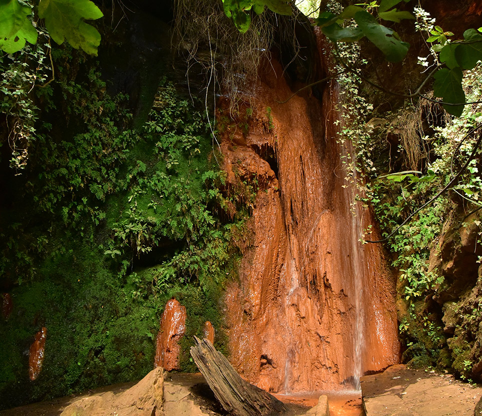
In the ‘barranco’ below the ‘ermita’, you’ll find an amazing sight – the El Chorrerón (waterfall). Here, you can see the effects of oxidised water on the nearby environment over the centuries. Did we meantion that it’s red? Yes, a red waterfall! This is a rare feature and worth taking the camera to capture the moment.
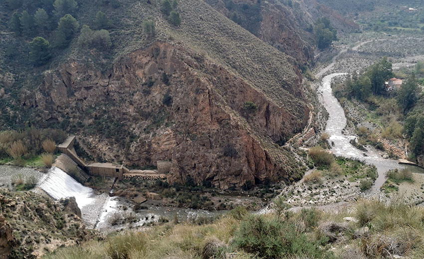
Dique 24, between Cáñar and Soportujar
Dique 24 was built in 1924, as a dam to control floods caused by water flowing down the Rio Chico, from the southern flank of the Sierra Nevada. The most obvious cause is from snow melt coming from the peaks. Dique 24 has an impressive 30m drop to its south side. Watch out for that if you go near with dogs or children!
After the recent precipitation in the Granada region, there’s currently an impressive waterfall and a dip pool on each side of the Dique.
For hikers on the GR7 trail between Cáñar and Soportújar, the Dique area is a popular resting spot. This section of the GR7 was improved recently by the Medio Ambiente (environment agency), making it safer and easier underfoot.

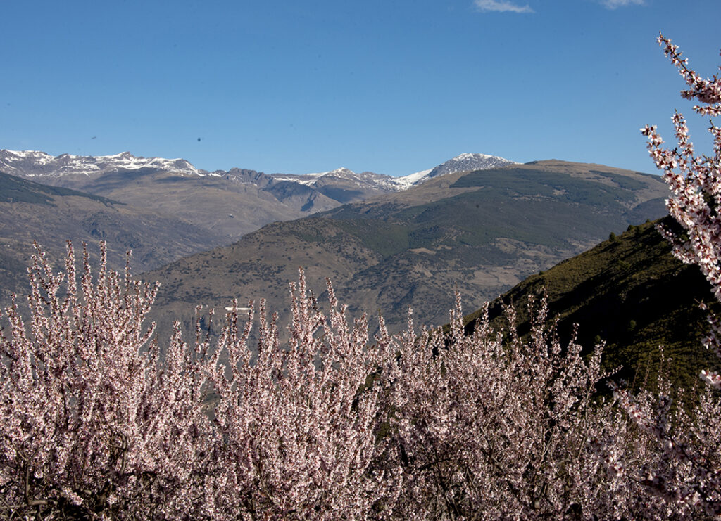
Almond blossom on the Sierra de Contraviesa (February/March)
One of the most beautiful sights throughout La Alpujarra in early spring is the “pretty in pink” almond blossoms that appear for a few weeks. Depending on the weather, the blooming can start in early January (or even at Christmas!). It commences on the lower, south-facing slopes – which receive the most sunlight – and then in the north-facing areas.
One of the prime locations to see almond blossom is the Sierra de Contraviesa. This is a smaller mountain range that joins La Alpujarra with the Costa Tropical, and is also known as the ‘Alpujarra Baja’ (low Alpujarra). Some of the most impressive blooms can be photographed from the mountain pass that winds its way above the village of Torvizcón, although this unnamed road is not for the nervous driver!
Even if it’s not almond blossom season, the Sierra de Contraviesa is well worth a visit. It promises panoramic views towards the Sierra Nevada and the sea.The A-4131 road, from near the Tablones of Órgiva, is an easy route to navigate and not too ‘hairy’.
The Poquiera valley
It’s far too difficult to pick one “wonder” that exists in the Poquiera valley, which forms part of the Alpujarra Alta (high Alpujarra). Therefore, we recommend a day trip to visit several attractions.
The Poqueira valley plays home to the closely-clustered white villages of Pampaneira, Bubion and Capileira, which are considered amongst the most beautiful in Spain. These villages are the perfect place to buy a woven Alpujarran rug or artisan leather goods, and to eat traditional gastronomy.
If you drive above Capileira, you’ll find yourself at the base of Mulhacen – the highest mountain peak in the Iberian Peninsular (at 3,479 meters). Although vehicle access is restricted part way up the mountain pass, at Hoya del Portillo, there is a way to get higher. During summer months, you can be transported ‘up top’ using a special bus service from Capileria (advance booking is vital). This sets passengers down within easy hiking distance of the peak, or the nearby Refugio Poquiera mountain refuge, which offers accomodation and food.
The Poqueira valley also offers marked hiking trails, recreation areas, impressive hydro electric installations, a horse riding centre, and a beautiful waterfall below Pampaneira.
El Duque area and Rio Guadalfeo
The famous author, Chris Stewart (‘Driving over Lemons’) is based near this remote and unspoilt area, which lies past Tijola – a desirable ‘suburb’ of Órgiva. And this really is a hidden gem! If you drive along the GR-4202 minor road (be careful not to tip your car into an adjacent ‘acequia’!), you’ll see the El Duque dam. This is similar to the Dique 24, but not as big. You can also glance due south towards the alternative settlement of Cigarrones and the village of Tablones, on the opposite bank of the Rio Guadalfeo. Further along the road, where the Rio Gudalfeo meets the Rio Trevelez, there is a 4×4 track down to the riverbed. This ‘secret paradise’ could be pretty for a picnic. Just ensure you don’t camp, leave no signs of your visit, and don’t try to cross any fast-running water and break your car.
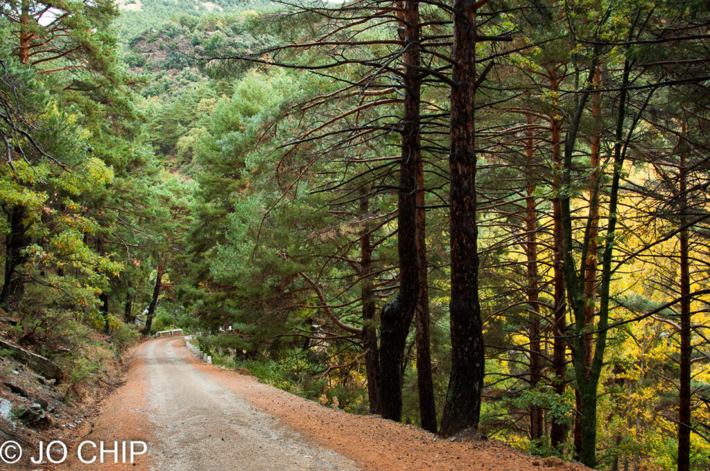
Puente Palo – above Cáñar
Situated in the muncipality of Cáñar, at approximately 1,800m, and bordering the municipality of Soportújar, Puente Palo is a quiet forestry recreation area surrounded by tall pine trees. Although the recreation area has a long-abandoned bar/restuarant, you’ll find several picnic tables in the shade where you can enjoy a sandwich and ‘cerveza’.
Just down from the recreation area, there’s a stone bridge crossing the Rio Chico. This is where the muncipality becomes Soportújar. In this area, you’ll find many marked hiking trails, including to Soportújar and Capileira, or up towards the Osel Ling buddhist retreat (more about that in a subsequent article). This unspoilt area is also popular with horse riders.
Take in the gorgeous scent of fresh pine… but don’t forget your fly spray in the summer months, or visit during dusk with no repellent!
Puerta de la Ragua (Almerian Alpujarra)
Although Google describes Puerta de la Ragua as a “modest, rustic area offering cross-country skiing, summer trekking and winter mountain climbing”, it’s more interesting in reality. The name ‘Puerta de la Ragua’ is apt as it’s a literal gateway between the Almerian Apujarra region, to the south, and the Guadix region, to the north.
If you hike above the main recreation area and carpark, you will enjoy panoramic views across the surrounding region, and breathe the freshest air. A breatakng mountain pass, the A-337 snakes through this area, reaching around 2,000 meters above sea level. This makes it one of the highest points in the area, and also one of th emost exciting drives (if not for the faint-hearted!). The pass can be closed in winter because of snow.
If you head towards Guadix, you will see the distant La Calahorra castle, which is an impressive landmark. When heading to the south, into the Almerian Alpujarra, it’s worth visiting the charming town of Laroles, which offers many good accomodation options and places to eat.