Jo Chipchase investigates whether recent reports concerning the risk of catastrophe at Rules Dam is a case of “come hell or high water” – or sensational journalism, now replaced by summer kite surfers and trout…
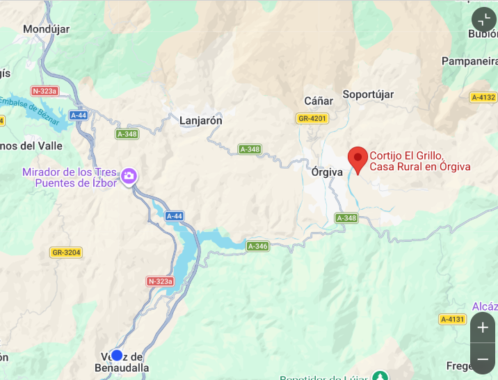
ANYONE following recent press coverage of Rules Dam (Presa de Rules), that sits on the River Guadalfeo, between the municipalities of Órgiva and Vélez de Benaudalla, might believe that part of southern Granada is on the verge of a geological catastrophe. Dam-busting water levels! Bank-bursting floods! Landslides! Basically ,’The Day After Tomorrow’ for anything that lies beneath Rules Dam.

According to earlier press reports, part of the surrounding countryside could slide into the reservoir. Roads could be damaged. Infrastructure could be affected. Long-suffering motorists might have to divert along the snaking N-323a – again! Noo! Please!
Or not.
Judging by a few random comments on local social media, some residents were unsettled by the reports. Hardly a surprise. Yet this is not a “mainstream” viewpoint. A visit to Rules Dam, by South of Granada, paints a very different picture to a cliff-hanging disaster. Rather, a picture of rural tranquillity. A nice place to visit.
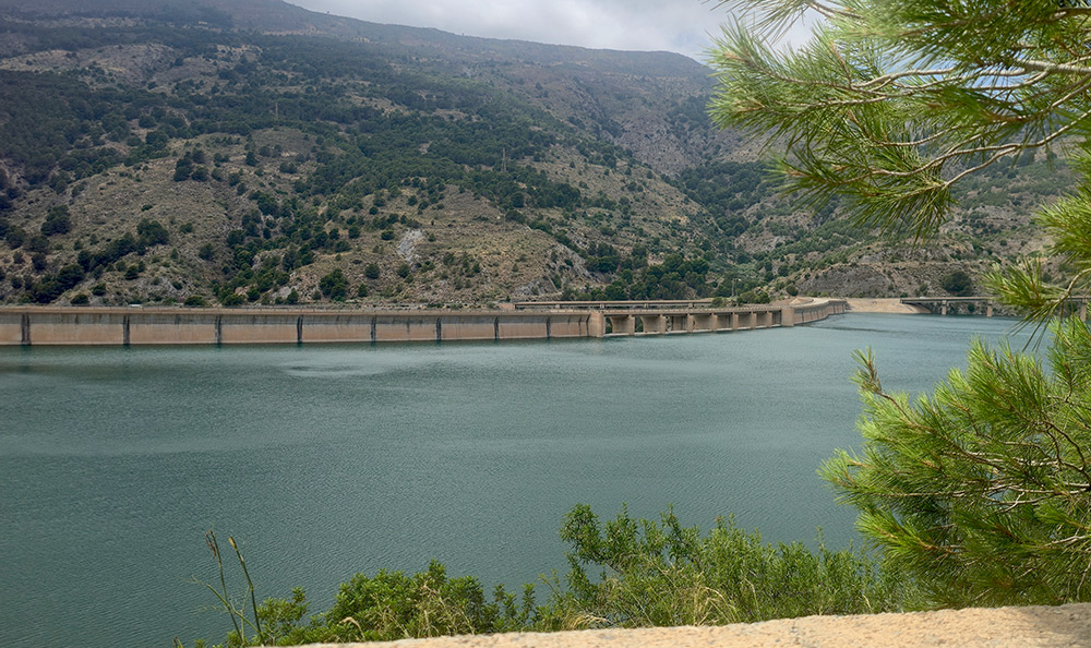
In an unusual spectacle, snowmelt from the Sierra Nevada recently caused the dam to reach almost record water levels. However, the excess flow has now abated. The spillway is quiet. The reservoir remains impressively full, but is no longer is pulling spectators to see roaring torrents of water running down the sides. The water has fallen 3.6% since the peak (source: Embalses.net).

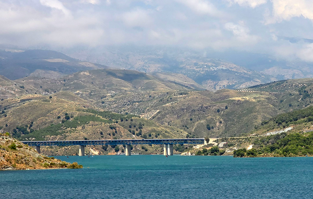
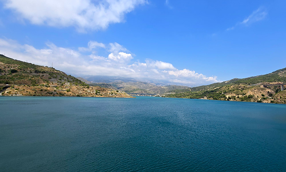
Looking downwards from the Rules Dam pedestrian walkway, you can see unconcerned trout swimming in the water below. Kite surfers have returned to the reservoir, making a pretty site with their coloured sails.
Summer, it seems, has arrived at Rules Dam.
Where is Rules Dam, exactly?
For those unfamiliar with the area ‘South of Granada’, the Rules Dam (Presa de Rules) was created to store water from the Rio Guadalfeo, between Órgiva and Vélez de Benaudalla. This is where the river exits the Alpujarra and heads towards the Costa Tropical.
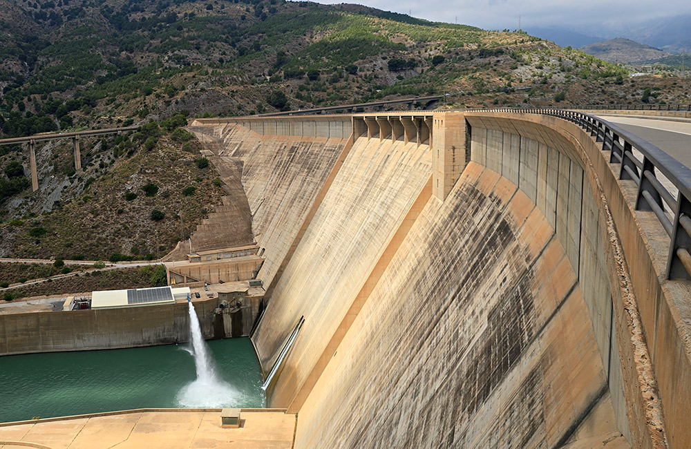
Rules Dam was inaugurated in 2004, after a lengthy construction that began in the late 1980s. The 132-metre-high structure was intended to provide flood protection, secure water supplies for the Costa Tropical, and irrigate thousands of hectares of agricultural land. More than 20 years later, however, much of the debate surrounding Rules Dam centres not on the reservoir itself, but on how to distribute the water stored behind it. Sigh!
Visible from the A-44 motorway, linking Granada and Motril, and crossed by the impressive Rules Viaduct, the reservoir collects water from much of La Alpujarra and the southern slopes of Sierra Nevada. It lies above one of Andalucía’s most important agricultural regions. It is a landmark in the area.
What local people make of the Rules Dam “overspill”
Away from the headlines, opinions are sensible. In a recent poll, on an English-language forum, 42% of respondents said they were pleased to see the reservoir full after the drought-afflicted water levels in 2025.
Meanwhile, 28% of respondents felt that water from the reservoir is wasted because of problems with the infrastructure.
A further 14% agreed that the reservoir sits in an area of known geological instability, while 14% felt that some of the media reporting had strayed into sensationalism. Clickbait, anyone?
A mere 1% said that they were “scared” of a dam disaster, while a further 1% believed that Rules Dam could collapse and flood Vélez de Benaudalla below.
The poll is hardly scientific, as it is based on a small sample. It does suggest that local people are more interested in water management than catastrophic scenarios.
From localised floods to Rules Dam overflow
Part of the confusion surrounding the Rule Dam “overflow” stems from two separate events running into one story.
The severe weather that affected Granada region in early February 2026 caused flood damage across the Alpujarra and Guadalfeo basin. South of Granada reported, at the time, on issues affecting roads, river crossings, and infrastructure, including the unmade roads serving Bayacas and Cigarrones. These were washed away.
In late May and early June 2026, continued inflows from the water table – and snowmelt from the Sierra Nevada – pushed Rules Dam briefly above its normal capacity, sending water cascading through the overflow system.
For a few days, Rules Dam became a spectator sport!
One English resident, from the Lecrín Valley, told South of Granada that it was the highest level he had seen in years. Press reports described it as the fullest in 16 years.
This reporting was accompanied by unhelpful descriptions that reservoir was “bursting its banks”. Reservoirs do not generally burst their banks. In reality, this means a functioning overflow system and controlled releases performing their designated function.
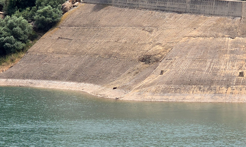
According to Embalses.net, Rules Dam reached approximately 105.9 hm³ at the beginning of June, equivalent to around 95% of its 111 hm³ capacity – yes, the highest level seen in many years. The reservoir has now begun its seasonal decline, standing at around 102 hm³ this week. You can already see where the water level has fallen on the banks.
The landslide story that became big news
As water levels reached peak heights at Rules Dam, most of the press focused on research into the El Arrecife landslide. This is a piece of terrain overlooking the reservoir. The area is, undeniably, known for its subsidence. The studies are important. The landslide is real.
The problem is that some readers believe a new threat had emerged.
In reality, researchers have been studying the E Arrecife slope for several years. Scientific papers examining instability at El Arrecife were published by the University of Granada in 2021, followed by further research in subsequent years.
. The landslide is not new but the latest modelling of what might happen under an extreme circumstances IS a ‘novedad’.
This involves a new study, widely published, examining worst-case scenarios. Researchers modelled what would occur if an earthquake of more than 6.0 magnitude triggered a slope failure, while the reservoir was close to maximum capacity. Has there been one of that magnitude? Err… no.
Modelling seismic activity and land movement is work that scientists should always do. But should it be tweaked and presented to the public for “doom scrolling” purposes, to scare them?
Granada remains one of Spain’s most seismically active provinces. La Alpujarra is no stranger to landslides, rockfalls, and unstable terrain. Ignoring geological risks would be foolish. Spectacularising them for clout is questionable.
As with Hantavirus, Ebola, and jet fuel shortages, the media loves this type of story.
The slope that closed a motorway
While some recent headlines exaggerated the danger, the geological issues surrounding Rules Dam are not academic. Motorists travelling between Granada and the Costa Tropical are all too familiar with the long-running saga of the Rules Viaduct on the A-44.
The 585-metre structure spans the reservoir between Ízbor and Vélez de Benaudalla and carries thousands of vehicles daily. To their chagrin, motorists have experienced repairs linked to slope instability and ground movement for years. Almost as long as Rules Viaduct has existed, in fact.
In 2023, studies identified (yet more) movement affecting the southern slope near Pillar Four of the viaduct. What began as reinforcement works eventually developed into a major engineering project. The motorway was initially closed between 9 September and 21 November 2025, before a second closure ran from 13 January until late February 2026, while engineers transferred loads from the affected Pillar Four to a newly constructed Pillar Five. The works were associated with the El Arrecife landslide and ground movement.
Many locals dread snaking along the old N-323 trunk road. The recent reinforcements do not mean that ground has stopped moving. The Rules viaduct will remain under long-term monitoring. The situation has already cost millions of Euros.
Yes, the slope is moving ‘poco poco’. Engineers know it. Scientists know it. The locals know.
However, pillar four (or five) of Rules viaduct moving gradually is different from suggesting that the dam is about to collapse!
Do we need a speculative script for a future Netflix ‘Trainwreck‘ episode?
The question that won’t go away
Another question for “concerned residents” is “what happens to the water captured by Rules Dam”? This has been debated since the reservoir was completed in 2004.
Rules Dam was intended to transform water management across the Costa Tropical and southern Granada, providing flood protection, water security and irrigation. Intended!
More than 20 years down the line, discussions about canalisations, pipelines, funding, and unfinished infrastructure are a recurring feature of local politics. Are there too many leaks? Are avocado farmers nicking water again?
In the age-old tradition of Spanish ‘Red Tape’, it takes a bureaucratic “achievement” to build a vast reservoir and then spend two decades arguing about how to deploy the contents. According to Cadena Sur, farmers, irrigation communities, business groups, and local authorities have repeatedly called for the completion of the long-delayed canalisation network. In March 2026, the ‘Plataforma por las Infrastructuras de la Costa Tropical‘ stated that, while the water resource exists, the infrastructure needed to take advantage of it remains a bit naff, to put it politely.
Looking beyond the headlines
Nothing in life is entirely risk-free. Geological studies remain important. Monitoring will continue. Scientists will assess the stability of El Arrecife and other slopes around the reservoir.
That said, a visit to Rules Dam paints a different picture from some of the alarmist reports.
The spillway is silent. The reservoir is slowly falling back to normal summer levels. Healthy ones. Not like last year, when you could see vast swathes of the banks and water depleting week-by-week. It looked a bit… sad.
Visitors can stop at the parking area beside the dam, stretch their legs along the walkway, and take in panoramic views across the reservoir, the Guadalfeo Valley, and towards the southern slopes of La Alpujarra. Have a cold drink, a sandwich, and enjoy the experience. Look for trout.
The geological risk is real.
However, the impression, on a warm summer afternoon is that Rules Dam feels less like an imminent disaster zone and more like an impressive piece of infrastructure, doing its job.
For now, Rules Dam is set for summer.